How to remove an internal border in Pan Zhi Hua city
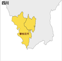
The problem definition:
The map after fix:
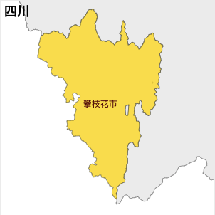
In an overview, let's single out Pan Zhi Hua city from Si Chuan province map, dissolve its internal borader and put it back
Details:
- Run mapmaker's
splitcommand, and split upecharts/map/json/province/sichuan.json. - Then
decompress 攀枝花市.geojson d_pan.geojson - Dissolve internal borders:
mapshaper d_pan.geojson -dissolve2 -o d_pan_shape_only.geojson - Please note,
d_pan_shape_only.geojsoncannot be used byecharts - Please
mapmakercommand:shaper2echarts d_pan_shape_only.geojson d_pan_shape_only_echarts.geojson 攀枝花市, so thatd_pan_shape_only_echarts.geojsoncan be used with echarts. - Before the geojson is inserted back, we'd better UTF8-ecode it:
compress d_pan_shape_only_echarts.geojson utf_encoded_pan_shape_only.geojson - Now let's put it back:
merge echarts/map/json/province/sichuan.json utf_encoded_pan_shape_only.geojson - Voila, here is the final geojson file:
merged_sichuan.json - If you want a javascript file, you need to run one more command:
makejs merged_sichuan.json sichuan.js 四川